


Mobile Topographer GIS


Mobile Topographer GIS介绍
专业人士的心爱选择,
移动地形仪 ...是否满足...的
GIS 。
现在,您可以不受任何限制进入的复杂性或数据量进行全面调查。
立即尝试移动地形仪GIS通过使用三天免费试用。只需下载应用程序,并与他签约的程序进行。虽然,你会被要求提供计费信息,您将不会在免费试用期三天结束前收取费用。您可以在这三天试用期内随时取消订阅,免费的。收费只会发生,如果在三天结束时,你仍然是有效的订阅。
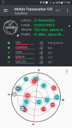
- 收集使用更高的精确度读数GNSS(GPS,GLONASS,伽利略,北斗,QZSS支持星座)。
- 通过模拟地点连接外部GNSS接收机和使用移动Topogrpaher GIS作为处理单元。
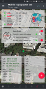
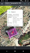
- 显示数据为WGS84或您当地的投影CRS。
- 从WGS84转换为本地投影CRS,反之亦然。
- 在地图上实时投影。
- ***新***自定义图像或WMS服务器地图背景。
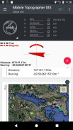
- 寻找在现实世界中一个标记点,通过使用“驱动我”
- 使用EGM模型或局部立面网格,其中可用的飞行计算正高。
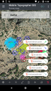
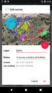
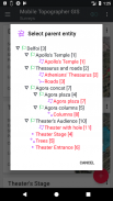
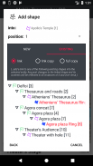
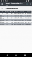
- 组织工作进入点 - 形状 - 实体和调查。现在,您可以创建单独的点,多点组,多折线,并与孔多多边形。
- 创建尽可能多的细节完整图纸,只要你想。
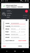
- ***新***大地测量工具。通过对以下选项添加间接点:1点+距离+方位,2点+距离+选择,2分+方位角,3分+的距离,线,分线的中点,延长线,平行线,垂直于线。
- 鸟巢的工作,在任何嵌套层次,打造一个超级的调查。
- 通过活动连接作业之间共享数据。
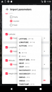
- 您的移动设备和桌面计算机之间交换工作岗位与进口 - 使用所有常见格式的导出功能.TXT,.CSV,.KML,.GPX,.DXF和形状文件(.SHP - .SHX - DBF)
- 协作与交流,并从一个点共享,以完成工作的合作伙伴。
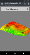
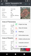
- 通过简单地通过它走创建一个区域的三维地形。
- 计算的轮廓,并将它们添加到以闪电般的速度,你的调查。
- 直接观看真实的3D模型到您的设备。
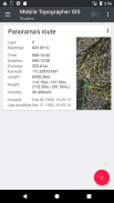
- 存储其数据的路由。
- 在这两个罗盘视图或AR信号信息显示GNSS卫星。
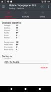
- 备份和使用SQL .db文件中恢复数据。
欢迎到移动测量的时代...!
查找更多关于移动GIS地形图仪在:
http://applicality.com/projects/mobile-topographer-gis/
从下载用户手册:
http://applicality.com/app_documentation/web/MobileTopographerGIS_Manual.pdf


Mobile Topographer GIS - APK信息
APK版本: 6.0.15程序包: com.applicality.mobiletopographergisMobile Topographer GIS的最新版本
其他版本


同类应用
您可能还会喜欢……
 4.273.434.094.414.213.77


